Geodata | Digital Maps for Wireless Network Planning
Modern geodata sets for accurate RF planning
Model your 5G network with confidence with high-resolution 3D building and vegetation maps

Highly accurate digital maps
A portfolio of digital maps to ensure accurate RF planning
Our premium geodata offering provides high-resolution (1-2m) digital maps with 3D building and vegetation polygons, designed specifically for RF planning. This is critical for accurate planning of 5G in dense urban areas and especially at mmWave frequencies. For areas where lower resolution data is acceptable, we offer a 2.5D medium resolution (5-10m) solution, ideal for suburban areas, and a 2D low resolution (20m+) solution for nationwide and large coverage footprints.

Key benefits and features
![]()
Improve your RF planning accuracy
Our best-in-class geodata, designed and validated specifically for RF planning, ensures an accurate baseline on which to plan.
![]()
Tailor the solution to your needs
Choose from a geodata portfolio covering high-resolution 3D data, medium resolution 2.5D data and low resolution 2D data.
![]()
Achieve maximum accuracy with 3D maps
Our Skylines geodata provides the highest resolution (1-2m) and 3D building and vegetation polygons, perfect for urban planning.
![]()
Balance cost and accuracy with 2.5D
Our Cityscapes HD geodata provides medium resolution (5-10m) maps with height data, perfect for suburban planning.
![]()
A cost-effective solution for nationwide coverage
Our Cityscapes geodata provides low resolution (20m+) maps, perfect for nationwide and large coverage footprints.
![]()
Enjoy hassle-free deployment
Fully compatible with your planning tool and propagation models and with a simple plug-and-play delivery structure.
Plan your 5G network with confidence
Learn how to leverage 3D digital maps to improve the planning accuracy of your 5G network
They trust us
Use cases
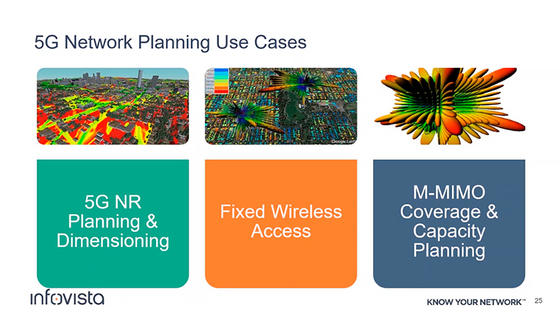
5G network planning

5G employs radically new technologies like massive MIMO and beamforming. To successfully plan these technologies as well as other aspects of 5G such as mmWave frequencies requires high resolution 3D maps which include 3D buildings and vegetation polygons. Our Skylines high resolution 3D map data ensures you can accurately plan your 5G network in complex dense urban environments and deliver the quality of service your customers expect.
5G network planning
5G employs radically new technologies like massive MIMO and beamforming. To successfully plan these technologies as well as other aspects of 5G such as mmWave frequencies requires high resolution 3D maps which include 3D buildings and vegetation polygons. Our Skylines high resolution 3D map data ensures you can accurately plan your 5G network in complex dense urban environments and deliver the quality of service your customers expect.
Planning in 3D

In many cities, 70-80% of mobile broadband traffic comes from indoor locations. This means the subscribers are not necessarily at ground level, making traditional 2D planning ineffective. To address this, you must be able to plan your network in 3D, and for that it is critical to have high resolution 3D building data such as that found in our Skylines geodata.
Planning in 3D
In many cities, 70-80% of mobile broadband traffic comes from indoor locations. This means the subscribers are not necessarily at ground level, making traditional 2D planning ineffective. To address this, you must be able to plan your network in 3D, and for that it is critical to have high resolution 3D building data such as that found in our Skylines geodata.
mmWave planning

5G has seen the adoption of mmWave frequencies. The high frequencies of mmWave spectrum can support massive bandwidths for eMBB use cases and high-capacity sites. The tiny wavelengths of these frequencies, however, suffer a lot of attenuation from obstacles. The highest resolution map data including 3D buildings and vegetation is therefore critical to successful mmWave planning. Without it, the coverage predicted in a planning tool will differ significantly from reality when the site is built.
mmWave planning
5G has seen the adoption of mmWave frequencies. The high frequencies of mmWave spectrum can support massive bandwidths for eMBB use cases and high-capacity sites. The tiny wavelengths of these frequencies, however, suffer a lot of attenuation from obstacles. The highest resolution map data including 3D buildings and vegetation is therefore critical to successful mmWave planning. Without it, the coverage predicted in a planning tool will differ significantly from reality when the site is built.
Related products and solutions

Planet
Deliver exceptional radio designs with the World’s first AI-powered planning solution


Accuracy makes business sense
A 1 dB improvement in RSRP modeling precision, could save a nationwide U.S. mobile network approximately $2 billion over a 10-year period

Read featured articles and publications

Network Planning for Fixed Wireless Access
Get actionable insights and real-world case studies to maximize the potential of Fixed Wireless Access and drive success for your business

How to successfully plan Fixed Wireless Access networks with Planet
Watch webinar to get valuable insights, expert guidance, and a live demonstration on how to plan your Fixed Wireless Access network in Planet

Geodata – Confidently model your 5G network with our high-resolution 3D building and vegetation maps
Download this datasheet to learn how to confidently model your 5G network with our high-resolution 3D building and vegetation maps with Geodata

Ellipse – Ensure your backhaul design and dimensioning seamlessly supports your mobile network
Deliver efficient backhaul dimensioning and microwave link planning with Ellipse

Planet - Deliver wireless network designs with AI-powered RF planning solution
Intelligently plan and optimize 2G, 3G, 4G and 5G networks with Planet’s powerful capabilities

Belgian tech firm ensures mission-critical communications throughout the entire network planning & optimization process with Planet from Infovista

How can you improve your coverage prediction accuracy and save you many hours of manual updates with Planet’s Antenna Relocation Tool?

We look at how use case-based web interfaces can transform the efficiency, accuracy and accessibility of your 5G RAN planning and optimization

What is RAN planning and optimization, why does it matter, and what does it take to make it effective? This blog explores the 5 key requirements.

The complex nature of 5G network deployments means planning is key. We look at how Smart CAPEX helps overcome common challenges to drive network ROI.

Infovista introduces use case-centric workflows in Planet Cloud to increase speed and accuracy of 5G network planning
New use case-specific web interfaces streamline 5G network design and reporting for mobile operators’ RF planning teams and senior management

Infovista unveils NLA Cloud Platform™ to unify cloud-native network planning, testing and automated assurance and operations
Extends proven cloud platform to scale and integrate telco-specific data, automation and analytics across operators’ network lifecycle to reduce CSP...

Infovista to showcase 5G Network Lifecycle Automation solutions at MWC Barcelona 2023
Introduces new cloud-native planning and testing solutions to Network Lifecycle Automation application suite for automated network planning, deploym...

Infovista to showcase innovative solutions to assure success of mission-critical networks at DoDIIS Worldwide Conference
Portfolio of planning, testing and Automated Assurance & Operations assurance solutions enables governmental agencies, operators and enterprises...

Botswana Telecommunications Corporation Limited (BTC) partners with Infovista for optimization of its mobile network
Advanced automation of network testing and crowdsourced data collection to combine with AI-powered RF planning to optimize BTC’s network, services a...
How to successfully plan Fixed Wireless Access networks with Planet
Watch webinar to get valuable insights, expert guidance, and a live demonstration on how to plan your Fixed Wireless Access network in Planet

How can data-driven RAN planning reduce the time and cost of 5G network deployment?
5G networks and services require a new approach to RAN planning and design that can efficiently reduce the time and cost of network planning and deplo...

Dimensione rapidamente o planejamento de 5G com Planet Cloud
Planejamento na nuvem traz recursos de automação em escala para operadoras móveis melhorar a qualidade do projeto e implementação de redes de 5G.

Planning for the future today: 5 prerequisites for effective 5G RAN planning
Discover the building blocks of effective LTE and NR RAN planning.

How to use crowdsourcing for network planning
Combining automation with access to 9 billion crowdsourced data points, Infovista’s Planet helps mobile operators make informed 5G RAN planning decisi...
Let's get in touch
Talk to one of our experts to answer your questions and get a demo of Geodata with no strings attached. Submit your contact details and we will get back to you shortly.
We’re looking forward to connecting!